
Aerial Reconstruction
Aerial Reconstruction supports 3DGS reconstruction of ultra-large models using only aerial images captured by a drone, without ground data captured by devices.
Workflow
Upload Aerial Data
- Aerial Data: Upload drone aerial-capture data. The interface will display the corresponding device type.
Drone RTK Data Toggle
v2.2.0 adds a drone RTK data toggle that controls whether RTK data recorded by the drone is used during aerial reconstruction.
- On (default): The system uses the drone's RTK data in reconstruction, generating a model with absolute coordinates.
- Off: The system completely ignores the drone's RTK data and reconstructs using visual data only; the model does not contain absolute coordinate information.
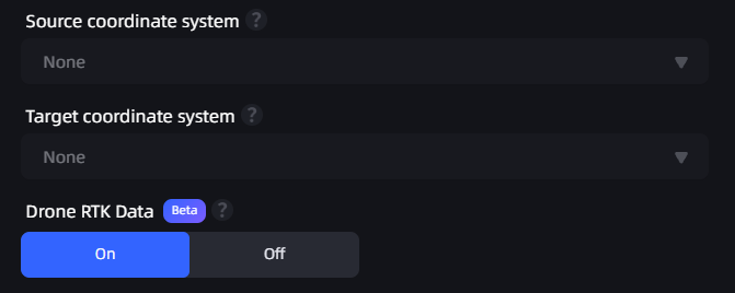
Aerial reconstruction coordinate conversion toggle
Usage Recommendations
- When the drone has RTK data, we recommend leaving the toggle on to obtain absolute coordinate positioning.
- When the drone does not have RTK data, the system automatically turns off the toggle and uses visual reconstruction only.
Important
When aerial reconstruction is performed with the drone RTK data toggle off (or when the drone does not have RTK):
- The model does not contain absolute coordinate information and cannot be exported to a GIS platform for geographic positioning.
- Image overlap requirements are higher: recommended forward overlap ≥ 80% and side overlap ≥ 70%.
- We recommend a grid or circular flight path to ensure sufficient coverage of the scene from all angles.
Enter the Model Name and Set Model Parameters
Aerial Data: Select the folder that contains drone-captured images. When selecting a folder, note the following:
- The folder must contain more than 100 and fewer than 10,000 images.
- Only JPG and JPEG image formats are supported.
- Image resolution must be higher than 1024×768, and every image must have the same resolution.
Note: The number of drone photos must not exceed 10,000.
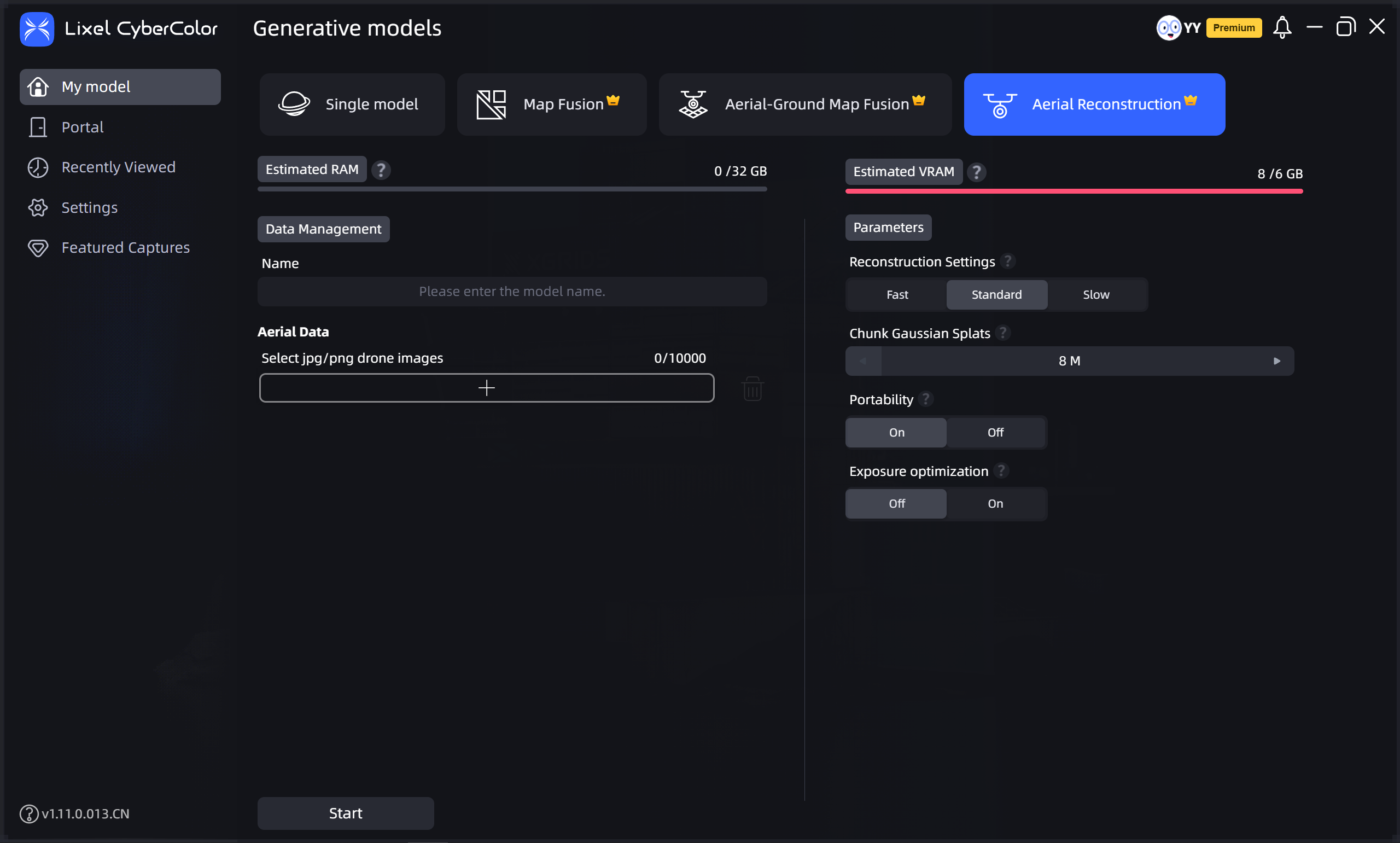
Aerial reconstruction