XGRIDSDocs
  • 简体中文
  • English
  • 繁體中文
  • 日本語
  • Deutsch
  • Español
  • Italiano
  • 简体中文
  • English
  • 繁體中文
  • 日本語
  • Deutsch
  • Español
  • Italiano
  • PortalCam

    • Product Overview
    • Basic Operation
    • Using the LCC Scan App
    • Maintenance and Care
    • FAQ
  • Lixel K Series

    • Lixel K1

      • Product Overview
      • Basic Operation
      • Device Activation and Connection
      • Scanning Workflow
      • Acquire Point Cloud Data with Absolute Coordinate
      • Map Fusion
      • Route Planning Suggestions for Typical Scenes
      • Precautions
      • FAQ
    • Lixel K2

      • Product Overview
      • Basic Operation
      • Device Activation and Connection
      • Scanning Workflow
      • Acquire Point Cloud Data with Absolute Coordinate
      • Map Fusion
      • Route Planning Suggestions for Typical Scenes
      • Precautions
      • FAQ
  • Lixel L Series

    • Lixel L2 Pro

      • Product Overview
      • Basic Operation
      • Device Activation and Connection
      • Scanning Workflow
      • Acquire Point Cloud Data with Absolute Coordinate
      • Measure Point
      • Appendix
      • FAQ
  • Lixel Studio

    • Version and Copyright
    • Installation and Activation
    • Software Interface
    • File Operations
    • Project Processing
    • Tools
    • 2D Drawing
    • Applications
    • Settings
    • Device Connection
    • FAQ
  • Lixel CyberColor

    • LCC Studio

      • Getting Started
      • Version and Updates
      • Download and Installation
      • Interface Overview and Navigation
      • Pre-Reconstruction Work
      • Model Reconstruction
      • Single Model Reconstruction
      • Map Fusion
      • Aerial-Ground Map Fusion
      • Aerial Reconstruction
      • My Models
      • Other Features
      • Settings and Account
      • Video Reconstruction
      • FAQ
    • LCC Scene Editor

      • Version & Updates
      • Account & Login
      • Product Overview & Home
      • Editor Interface
      • Scene Navigation Modes
      • File
      • Settings
      • Edit Operations
      • Window
      • Global Toolbar
      • Assets & Properties
      • Left Toolbar
      • Viewpoints
      • Portal
      • Skybox
      • Annotations
      • Measurement
      • Flythrough
      • Scene Report
      • 3D Layout
      • Preview Mode (Viewer)
      • Help
      • FAQ
      • Spawn Point
    • LCC Model Editor

      • Version and Updates
      • User Guide
      • Overview and Interface
      • File Operations
      • Selectors
      • Editing Models
      • Measurement
      • Color Grading
      • Asset Management
      • Settings and Help
      • FAQ
    • 04-capture-guide

      • Overview
      • Capture Devices Overview
      • General Capture Principles
      • Indoor Scene Capture
      • Outdoor Scene Capture
      • Large-Scale Capture (Map Fusion)
      • Aerial-Ground Map Fusion Capture
      • Object Capture
      • People Capture
      • Video Reconstruction Capture
      • HD Enhancement
      • Control Points (Lixel P1)
      • FAQ and Troubleshooting
    • Version History

Aerial-Ground Map Fusion

Aerial-Ground Map Fusion fuses drone-captured aerial images with ground capture data for multi-perspective, multi-scale integrated modeling. It more comprehensively restores the spatial structure and detail of large complex models, improving the completeness and realism of 3D models.

Workflow

Upload Ground and Aerial Data

  • Ground Data: Upload data files captured by L series or PortalCam devices. The interface displays the corresponding device type.
  • Aerial Data: Select the folder containing drone-captured images. Note the following when selecting:
    • The folder should contain between 100 and 10,000 images.
    • Only JPG and JPEG format images are supported.
    • Image resolution must be higher than 1024×768, and all images must have consistent resolution.
    • For PortalCam devices, you need to upload aerial photos and takeoff/landing point photo folders at the corresponding aerial-ground fusion points (if no aerial-ground fusion point was marked at the drone takeoff/landing point during capture, uploading aerial photos directly may result in reduced aerial-ground fusion quality or reconstruction failure).

Note:

  • Up to 10 ground data segments are supported, and the total ground data duration must not exceed 200 min.
  • The number of drone photos must not exceed 10,000.

Drone RTK Data Toggle

v2.2.0 adds a drone RTK data toggle to control whether to use RTK data recorded by the drone during reconstruction.

  • On (default): The system will use the drone's RTK data in reconstruction.
  • Off: The drone's RTK data is completely ignored during reconstruction.
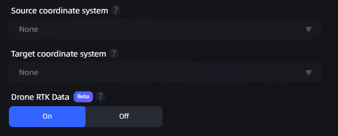
Coordinate Transform Toggle

Coordinate transform toggle (ground data / drone data)

Recommended Combinations

The following combinations lower hardware requirements and are recommended:

Ground DataDrone DataDescription
L series RTKDrone RTKRecommended, highest accuracy
P series aerial-ground fusion control pointsDrone RTKRecommended
P series aerial-ground fusion control pointsDrone without RTKRecommended, lowers the drone hardware barrier, supports consumer-grade drones

Not Recommended Combination

The following combination may cause reconstruction failure or layer separation in the model. Please avoid using it:

Ground DataDrone DataRisk
L series RTKDrone without RTK⚠️ May cause reconstruction failure or layer separation

Usage Tips

  • P series devices: You can reconstruct without drone RTK (turn off the drone RTK data toggle). Combined with aerial-ground fusion control points, this yields good results.
  • L series devices: It is recommended to keep ground RTK + drone RTK (turn on the drone RTK data toggle) to improve reconstruction success rate.

Set Model Name and Parameters
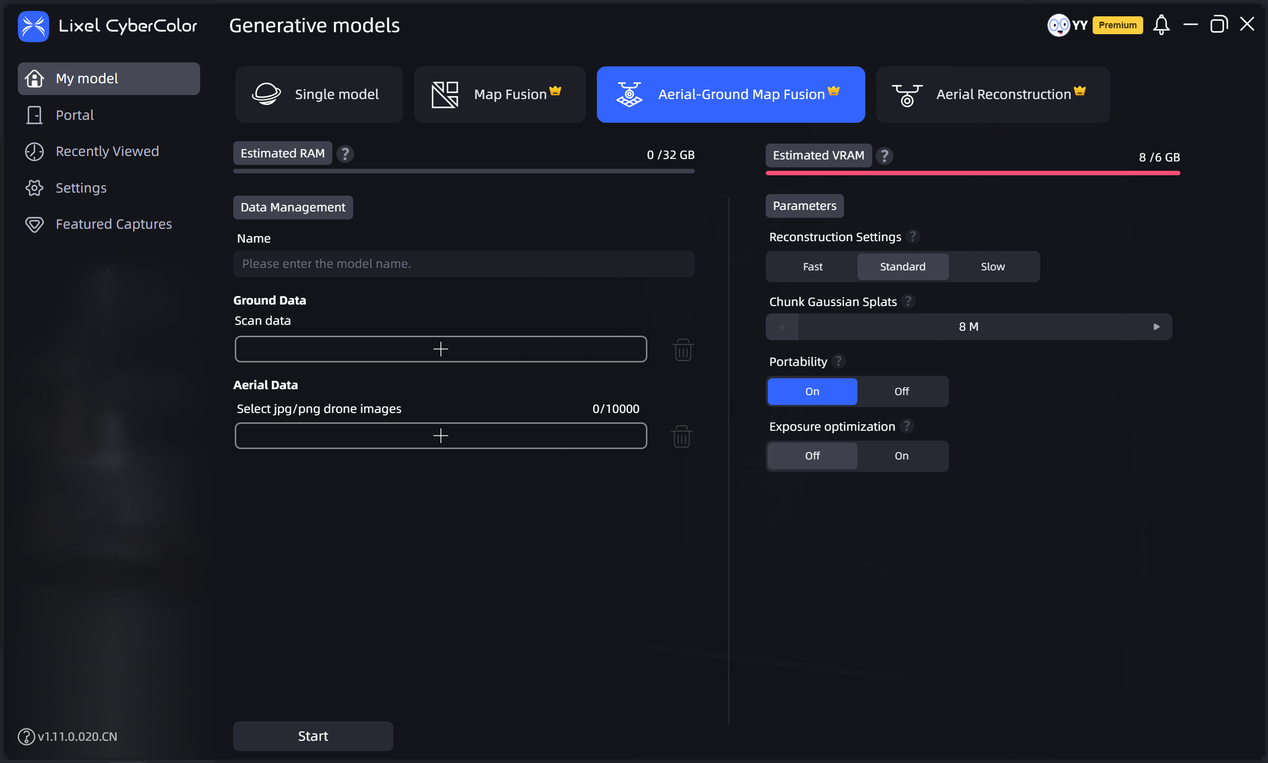
Aerial-Ground Map Fusion
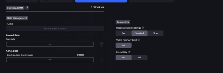
Aerial-Ground Map Fusion

Aerial-Ground Map Fusion (without control points)
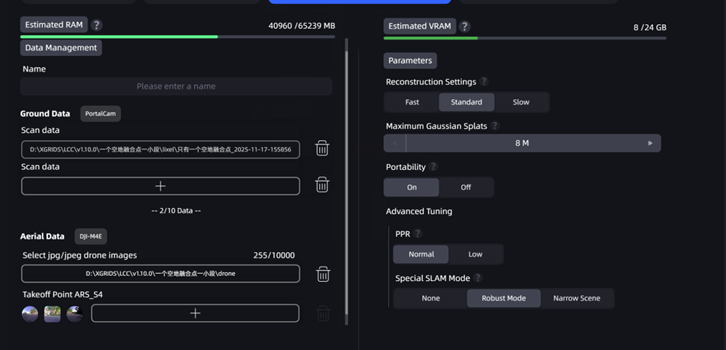
Aerial-Ground Map Fusion (without control points)

Aerial-Ground Map Fusion (with control points)

Aerial-Ground Map Fusion (with control points)

Prev
Map Fusion
Next
Aerial Reconstruction