XGRIDSDocs
  • 简体中文
  • English
  • 繁體中文
  • 日本語
  • Deutsch
  • Español
  • Italiano
  • 简体中文
  • English
  • 繁體中文
  • 日本語
  • Deutsch
  • Español
  • Italiano
  • PortalCam

    • Product Overview
    • Basic Operation
    • Using the LCC Scan App
    • Maintenance and Care
    • FAQ
  • Lixel K Series

    • Lixel K1

      • Product Overview
      • Basic Operation
      • Device Activation and Connection
      • Scanning Workflow
      • Acquire Point Cloud Data with Absolute Coordinate
      • Map Fusion
      • Route Planning Suggestions for Typical Scenes
      • Precautions
      • FAQ
    • Lixel K2

      • Product Overview
      • Basic Operation
      • Device Activation and Connection
      • Scanning Workflow
      • Acquire Point Cloud Data with Absolute Coordinate
      • Map Fusion
      • Route Planning Suggestions for Typical Scenes
      • Precautions
      • FAQ
  • Lixel L Series

    • Lixel L2 Pro

      • Product Overview
      • Basic Operation
      • Device Activation and Connection
      • Scanning Workflow
      • Acquire Point Cloud Data with Absolute Coordinate
      • Measure Point
      • Appendix
      • FAQ
  • Lixel Studio

    • Version and Copyright
    • Installation and Activation
    • Software Interface
    • File Operations
    • Project Processing
    • Tools
    • 2D Drawing
    • Applications
    • Settings
    • Device Connection
    • FAQ
  • Lixel CyberColor

    • LCC Studio

      • Getting Started
      • Version and Updates
      • Download and Installation
      • Interface Overview and Navigation
      • Pre-Reconstruction Work
      • Model Reconstruction
      • Single Model Reconstruction
      • Map Fusion
      • Aerial-Ground Map Fusion
      • Aerial Reconstruction
      • My Models
      • Other Features
      • Settings and Account
      • Video Reconstruction
      • FAQ
    • LCC Scene Editor

      • Version & Updates
      • Account & Login
      • Product Overview & Home
      • Editor Interface
      • Scene Navigation Modes
      • File
      • Settings
      • Edit Operations
      • Window
      • Global Toolbar
      • Assets & Properties
      • Left Toolbar
      • Viewpoints
      • Portal
      • Skybox
      • Annotations
      • Measurement
      • Flythrough
      • Scene Report
      • 3D Layout
      • Preview Mode (Viewer)
      • Help
      • FAQ
      • Spawn Point
    • LCC Model Editor

      • Version and Updates
      • User Guide
      • Overview and Interface
      • File Operations
      • Selectors
      • Editing Models
      • Measurement
      • Color Grading
      • Asset Management
      • Settings and Help
      • FAQ
    • 04-capture-guide

      • Overview
      • Capture Devices Overview
      • General Capture Principles
      • Indoor Scene Capture
      • Outdoor Scene Capture
      • Large-Scale Capture (Map Fusion)
      • Aerial-Ground Map Fusion Capture
      • Object Capture
      • People Capture
      • Video Reconstruction Capture
      • HD Enhancement
      • Control Points (Lixel P1)
      • FAQ and Troubleshooting
    • Version History

Aerial Reconstruction

The Aerial Reconstruction feature supports 3DGS reconstruction of ultra-large models using purely drone aerial photos without ground device capture data.

Workflow

Upload Aerial Data

  • Aerial Data: Upload drone aerial data. The interface displays the corresponding device type.

Drone RTK Data Toggle

v2.2.0 adds a drone RTK data toggle to control whether to use RTK data recorded by the drone during the aerial reconstruction process.

  • On (default): The system will use the drone's RTK data in reconstruction, generating a model with absolute coordinates.
  • Off: The drone's RTK data is completely ignored; the system uses pure visual SfM for reconstruction, and the model will not contain absolute coordinate information.
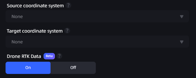
Aerial Reconstruction Coordinate Transform Toggle

Aerial reconstruction coordinate transform toggle

Usage Tips

  • When the drone has RTK data, it is recommended to keep the toggle on for absolute coordinate positioning.
  • When the drone does not have RTK data, the system will automatically turn off this toggle and use pure visual reconstruction.

Note

When the drone RTK data toggle is off (or the drone does not have RTK):

  • The model will not contain absolute coordinate information and cannot be exported to GIS platforms for geographic positioning.
  • Higher image overlap is required: forward overlap ≥ 80%, side overlap ≥ 70% recommended.
  • Grid or orbit flight paths are recommended to ensure sufficient coverage from all angles.

Set Model Name and Parameters

Aerial Data: Select the folder containing drone-captured images. Note the following when selecting:

  • The folder should contain between 100 and 10,000 images.
  • Only JPG and JPEG format images are supported.
  • Image resolution must be higher than 1024×768, and all images must have consistent resolution.

Note: The number of drone photos must not exceed 10,000.
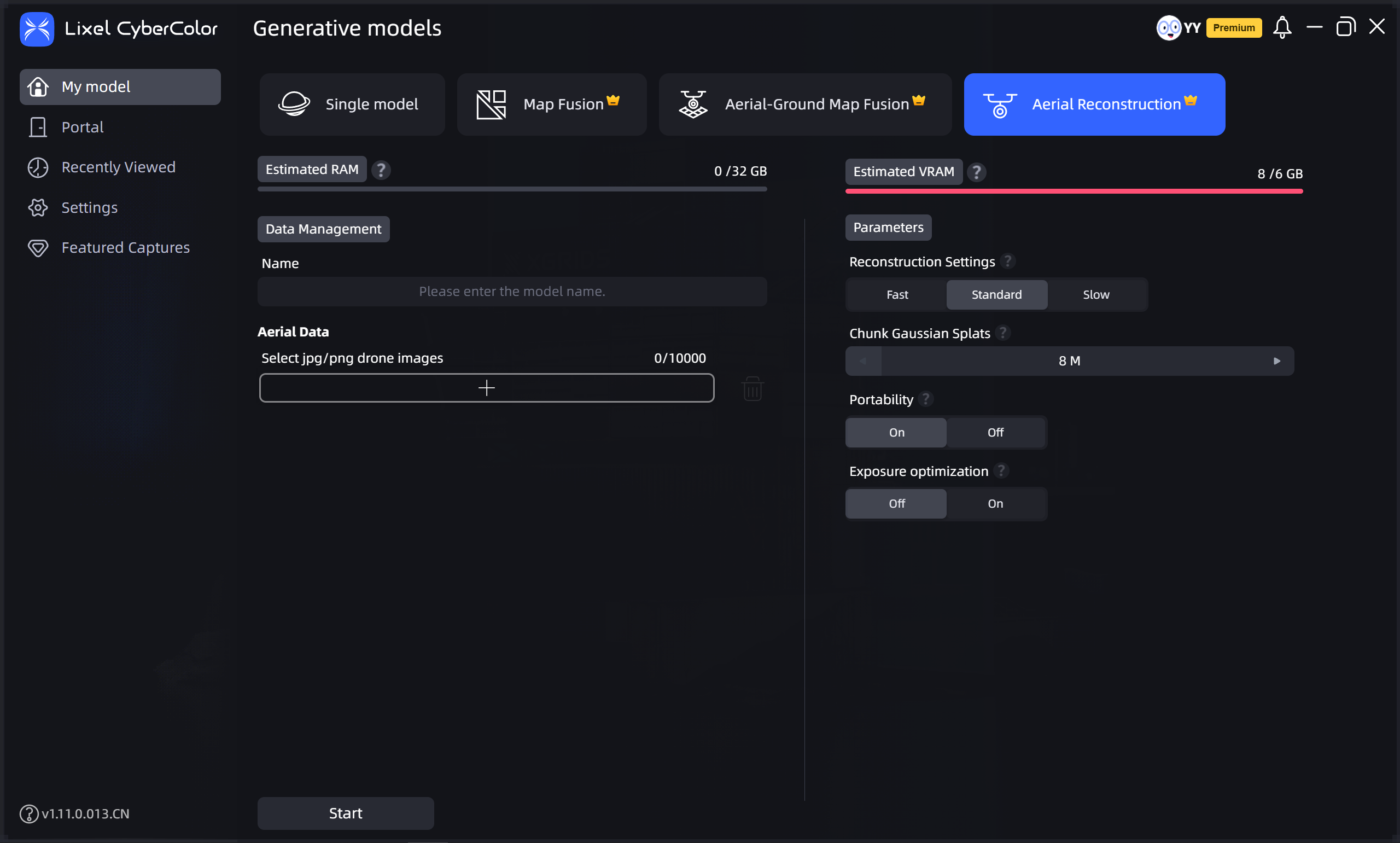
Aerial Reconstruction

Aerial Reconstruction

Prev
Aerial-Ground Map Fusion
Next
My Models